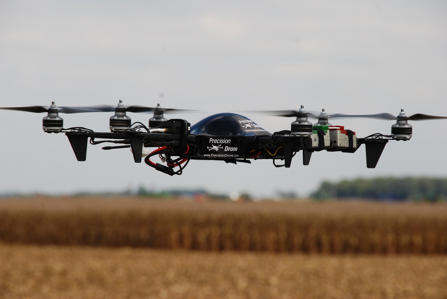
Agweb.com recently wrote an article on the expected rise in drones in agricultural operations. Having experience with drones ourselves, we definitely see their benefits on the farm and expect farmers will also. Click here to view the AgWeb.com article, and be sure to check out our Drones page to view our Pacesetter 2 drone and why it flies above the rest of the competition!
Call Eli Fred at 574-224-8324 for more information on drones and how they can help you make data-driven decisions to add to your bottom line!
From spring to harvest, you can utilize drones to help make sure you are making data-driven decisions on your farming operation to help generate the best possible yields on your fields. Here are a couple of examples we have used the Precision Drone Pacesetter 2 to accomplish that:
Precise Yield Estimations
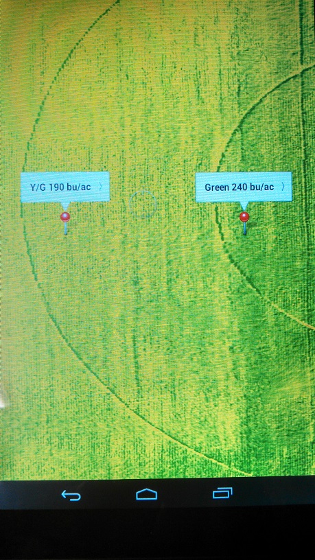
The Pacesetter 2 is also a great tool to help you market your crop and create a strategic game plan long before harvest. Simply fly your fields and create an NDVI geo-referenced crop health map so you can identify healthy, moderate, and struggling areas of your fields. These values are represented in the NDVI image as colors of green, yellow, and orange/red using the Precision Vision software that comes with the Pacesetter 2 package. With that NDVI map you created, pick a GPS point that represents each color of the map and conduct a physical yield check in the field for those spots. Import this NDVI map into any farm software of your choice to determine the percentage of healthy, moderate, and struggling crop in your fields.
Here are two pins of GPS points where yield estimations were taken based off of the NDVI map created by the drone.
Using the yield check estimates gathered in the field and the percentage of each crop health color derived from the NDVI map, you can determine what type of average yield to expect per field. Here is the actual data from the physical yield check where we came within 0.5% of what the actual yield monitor showed 2 months prior to harvest: 2015 Pacesetter Drone Yield Estimation
What the Naked Eye Can’t See
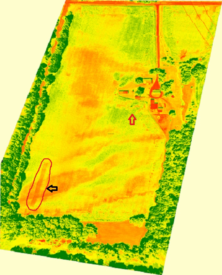
The Pacesetter can also help you find many issues in your fields throughout the growing season, such as the one in this NDVI map, where the tank ran out of anhydrous before the end row was reached.
The Pacesetter helps you identify problems in your fields. Here is an actual example of an NDVI image shown from the Pacesetter software indicating where the tank ran out of anhydrous during side-dress application.
The red arrow shows where corn was ran over and knocked down at the field entrance when NH3 nitrogen was being side-dressed. Also visible, is the variation of soil types and how they are affecting crop health. The orange areas of this field show you where the sandy soil is causing the corn plants to struggle more than the rest of the field. The Pacesetter does not only let you see the health of your crops, but can also be used to help you:
Create variable rate fertilizer and/or seeding maps using any major farm software
Find replant opportunities and determine how many acres are affected
Determine amount of crop damage for crop insurance purposes
Find planter and/or applicator malfunctions
Monitor specialty crops and/or seed variety test plots
Spot where weed pressures are hurting crop health
Locate disease and/or insect pressures
If you would like additional information about the Pacesetter 2 drone and how this innovative product can help you make better management decisions during the next growing season, call Eli Fred at 574-224-8324 today!